Overview
We have a few ‘virtual’ orienteering courses set up in the Settle Harriers area that you can complete on your own as training events – but with a competitive edge.
Generally little navigation experience is needed although you will need to be able to read a map. You won’t need a compass in good weather but for some of the courses you might want one in the mist.
These virtual courses have a defined set of locations (‘controls’) you need to visit but there are no physical markers at the controls – instead we use a GPS smartphone app called MapRun to identify and record when each control has been visited. At the end of your run, your results are displayed and are stored on a server so you can see your ranking compared with other people who’ve completed the same course.
Some of the courses are ‘linear’ where you just visit the numbered controls in the correct order as fast as you can. Other courses are ‘score’ courses where controls have different points values and you have a fixed time (eg 60 minutes) to get as high a score as possible. For these there is a score penalty for going over time.
How to get ready to take part
You need to install an app called MapRun which is available on the Apple App Store or Google Play for Android. Once you have installed it, please fill in your personal details (name, age etc), which are needed to display your results in your age category. The guy who maintains the app is a dedicated orienteer in Australia – there shouldn’t be any worry about getting spammed etc if you provide your email address.
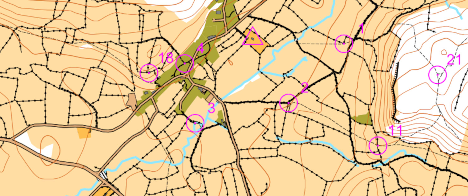
Although the app will display a map of the course to follow, it’s much easier to use a printed map and these can be downloaded from the list of available courses below. You should print the map in colour if possible! For the ‘score’ courses, the points value for each control is also printed on the map.
Settle Harriers MapRun courses
These are the courses currently available. We hope to add to this list steadily with courses being created around the patch. If you’re keen to develop a new one, get in touch with Simon Oxley who can work with you to add a course.
Course name |
Description |
Location of start/finish |
Scoring details |
Link to map for download |
Link to results |
| Settle Street | A ‘score event’ course around the Settle and Giggleswick area both in town and the outskirts | Start: The obelisk in the market Square
Finish: In the Talbot Arms car park |
Visit as many controls as you can in 50 minutes.
Penalty of 10 points per minute (or part minute) over the hour |
Settle orienteering map | Settle results |
| Gigg Scar | A linear course over Giggleswick Scar – about 9km | South west corner of the Settle swimming pool car park | Just a timed run – visit each control in the correct numbered sequence as fast as you can | Giggleswick Scar orienteering map | Gigg Scar results |
| Stainforth Handicap | The 10km road circuit we’ve been using for occasional Monday night handicap runs (Settle-Langcliffe-Stainforth-Stackhouse-Settle) | Outside the HSBC bank in Settle market square | Just a timed run. There are only 2 controls on the course but follow the route on the map for the correct 10k run. | Stainforth 10K map (and 5k course) | Stainforth results |
| Austwick Night Score | A ‘score event’ around the Austwick fields/fells. Originally created as a night orienteering event but can be completed in daylight! | Just in front of the pavilion at the Austwick tennis club | Visit as many controls as you can in 60 minutes.
Penalty of 10 points per minute (or part minute) over the hour |
Austwick orienteering map | Austwick night results |
| Austwick O (Walkers) | Identical course to the Austwick Night Score but with a 2 hour time limit to make it more feasible for people who want to do it as a walk. | Just in front of the pavilion at the Austwick tennis club | Visit as many controls as you can in 120 minutes.
Penalty of 10 points per minute (or part minute) over the hour |
As above. | Austwick walkers results |
| Settle 6 Trigs | A long route (ca 40km) doing a circuit of 6 trig points around Settle. The trigs are Smearset, Moughton, Sulber, Penyghent, Warrendale Knotts and Hunter Bark.
You need a phone with a good battery life to keep MapRun going for this one! The course has a PIN to load the map. This is 4967. |
The obelisk in Settle market square | The idea is to do all the trigs in any order you like. However, it’s actually set up as a ‘score’ event so you can just do some of them if you like and you’ll get in the results table. | Settle 6 Trigs map | Settle 6 Trigs results |
| Caves and Cairns | A linear course of about 15km around Crummackdale design by Mike Bottomley. An interesting tour of cave entrances and peaklets.
Probably a good idea to take a compass for this one. And take a lot of care in poor visibility – there are places you could fall down! |
The track (Thwaite Lane) on the western side of the ‘crossroads’ up above Townhead in Austwick | Just a timed run – visit each control in the correct numbered sequence as fast as you can. | Caves and Cairns map | Caves and Cairns results |
| Attermire Scar | A linear course of about 7.8km and 360m of climb over Attermire Scar area. Designed by John Wooton.
Please don’t climb any walls. |
On the track towards Langcliffe after the gate at the top of Banks’ Lane | Just a timed run – visit each control in the correct numbered sequence as fast as you can. | Attermire Scar map | Attermire Scar results |
| Ingleton Streets Night O | A linear course of about 4.8km round Ingleton. Designed to be run in the dark – but that’s up to you!
Designed by Lakeland Orienteering Club who have kindly allowed us to use it.. |
Near the Community Centre Car Park – see the triangle on the map | Just a timed run – visit each control in the correct numbered sequence as fast as you can. | Ingleton Streets Night O map | Ingleton Streets Night O results |
| Crina Bottom | A linear course of about 7.5km round Ingleton. Needs some careful navigation! | At the fell gate at the top of Fell Lane GR 719733 | Just a timed run – visit each control in the correct numbered sequence as fast as you can. | Crina Bottom map | Crina Bottom results |
Starting and completing a course
Start the MapRun6 app and either:
- Select Events Near Me to show the courses within a couple of km of your current location
- Use Event List to find a particular course (ours are in the UK>Yorkshire Dales folder)
When you are ready to run, click on Goto Start – this will display the map on your phone – but you may find it easier to use the printed one.
The course is now live, and your location and track are shown on the screen so that you can see if your GPS is working. These will disappear as you start so you can’t use the app to work our where you are! Go towards the start area as shown on the map and get ready to run. The app will automatically start logging your track and time when you pass within about 10m of the Start. The phone will beep indicating your timer has started.
Now just follow your course around the controls and as you get within about 10m of each one your phone will beep and display a message saying the control has been registered. If it doesn’t do this immediately, circle around the control for a bit – it can take a few seconds for your GPS to register your location. If it still doesn’t register, start wondering if you’re in the wrong place!
When you get to the finish the timer will stop automatically and you will be given the option to upload your results to the server. This will then allow you to see your position in the rankings for the course. You can also configure MapRunF to upload your route directly to Strava.
Please note
Do not climb any walls or fences – just use stiles/gates.
Be careful around town – running into traffic while concentrating on the map is uncool.


